Latest cycle
Loading…Every chart here is rendered before you ask for it — a fixed, editorially-chosen set of domains and products, drawn to one standard end to end. Nothing is computed on request, so the thousandth viewer costs no more than the first. Fixed frames, but unlimited points: soundings and meteograms come straight from the ensemble store.
Examples
REFERENCE BROADCAST RENDERS · RRFS-A 3 KM PRECIPITABLE WATER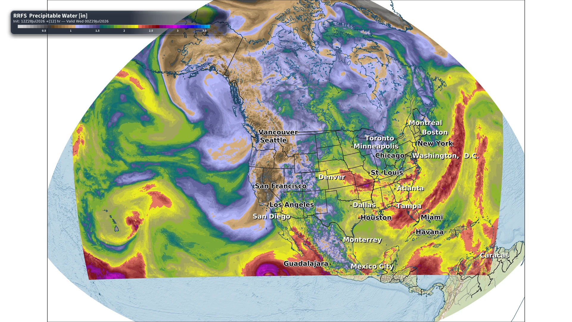
North America · orthographic globe. Natural-Earth relief through a translucent moisture field, floating city labels that lie on the curved surface, and the College of DuPage inches scale.
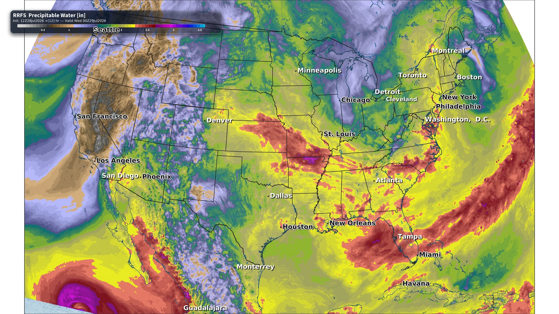
CONUS · satellite oblique. The same field on a near-side perspective — the “from orbit” tilt, with the Earth’s curvature falling to a horizon. The fixed ECMWF library below is drawn to this same standard.
Domains
Products
This cycle
Why fixed maps
Everything is already drawn
Every viewer in the world requests the same URLs, so the CDN answers almost all of them and origin load stays flat. No render sits on the critical path of a click.
The basemap is solved once
For a fixed frame the relief, coastlines, borders and label placement are identical across every product and every hour. Solve once, composite forever — which is why the type can be this good.
Rendering ahead changes what fits
An on-demand viewer can only show fields cheap enough to compute in a request. Drawing ahead means an ensemble probability field costs the same as mean sea level pressure.